North Carolina Smokies
Why they're called Smoky
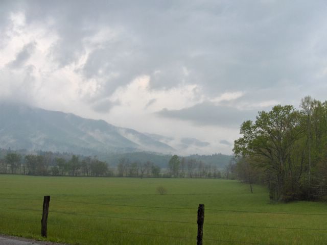
We woke up to foggy rain, so we decided not to hike and instead spent the day driving around parts of the park we hadn't been to yet. The fog was think in Cades Cove. From there, we took Rich Mountain Road because the Parson Branch Road was still closed, probably flooded. RMR was a fast climb with lots of switchbacks and was mostly unpaved. We were relieved to finally reach the top. We next headed to the Foothills Parkway and then Hwy 129 to Fontana Dam. Right before the dam the road again climbed and was one switchback after another. We were surrounded by a swarm of Mini Coopers, and when we finally go to the dam town we found even more--some sort of Mini convention. To stave off further carsickness, we grabbed some snacks at the dam store. Think we saw some AT thru-hikers hanging around on the porch. We drove across the dam and took photos of the Welcome to the Smoky N. P. sign, where we saw more hikers headed south. Back on the road, we headed southeast into the Nantahala National Forest, eventually turning back north in Bryson City and going through the town of Cherokee on the Cherokee Indian Reservation. The other visitor center, the Oconaluftee, was already closed by the time we arrived. Newfound Gap Road took us back up to familiar park territory. A long day in the car, but worth it for the great views and the chance to see more of the park than our "home" corner by Gatlinburg.
(written by H)
posted by MCV @ 9:56 PM
![]()
![]()


0 Comments:
Post a Comment
<< Home